MAPPING

2000 East Boston Master Plan

Source: http://www.bostonplans.org/planning/planning-initiatives/eastbostonmasterplan The East Boston Master Plan provides a framework for new growth and development in the community’s commercial districts and waterfront area, while preserving and enhancing the quality of life in the community’s residential neighborhoods. Many of the recommendations from the April 2000 plan have been implemented including but not limited to the creation

2000 East Boston Master Plan Read More »

NHERI, DESIGN SAFE, NSF

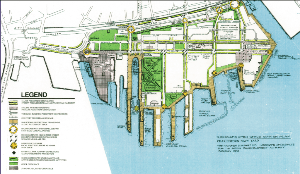
Flood Maps COASTAL RESILIENCE TRACKER https://boston.maps.arcgis.com/apps/Cascade/index.html?appid=c438a8a66e9d470b8b305a973fc192f7 CLIMATE READY MAP EXPLORER Climate Ready Boston Map Explorer COASTAL FLOOD RESILIENCE DESIGN GUIDLINES Coastal Flood Resilience Design Guidelines CLIMATE READY MAP EXPLORER https://www.boston.gov/departments/environment/climate-ready-boston-map-explorer 2010 Greenway District Planning Study Use and Development Guidelines. *Charlestown not included. CoMap https://www.google.com/search?q=figure%2068%20Charlestown%20Navy%20Yard%20Open%20Space%20Master%20Plan&tbm=isch&tbs=rimg:CcQbr4x7ncmgYT4pSjGdE_1OO&hl=en&sa=X&ved=0CBsQuIIBahcKEwjIwcaswp3wAhUAAAAAHQAAAAAQAg&biw=1440&bih=707 BPDA INTERACTIVE MAP  BPDA Launches Interactive Map BPDA OWNED LAND BPDA

NHERI, DESIGN SAFE, NSF Read More »

2020?

https://www.semanticscholar.org/paper/Exclusion-in-Upscaling-Institutions%3A-The-of-in-an-Berrelleza/b206838b7b64021d9ce290117995551404205e58 Exclusion in Upscaling Institutions: The Reproduction of Neighborhood Segregation in an Urban Church Erick Berrelleza Published 2020 Geography City & Community This paper examines the intersection of neighborhood change and parish reconfiguration in Charlestown, MA. The merger of two Roman Catholic churches has unsettled the congregational cultures, just as gentrification is unsettling broader neighborhood

2020? Read More »