.jpg/:/cr=t:0%25,l:0%25,w:100%25,h:100%25/rs=w:400,cg:true)
Christopher Nicodemus, Charlestown, MA
What began as a group of concerned citizens concerned about the public process address the fate of pier 5 has turned into the establishment of a new organization focused on neglected pieces of the Boston waterfront, especially here in Charlestown. The P5A is now a 501C3 organization focused on bringing together the broader community to address neglected pieces of our waterfront and assure that these valuable but extensive community assets remain in the public domain though public private partnership and responsible planning.
The city needs to secure and make sustainable its waterfront…the piecemeal approach of passing the buck to developers to take on the responsibility may work in the short haul. However, neglected and inappropriately managed infrastructure that can be cherry picked by developers for the low hanging fruit while the rest of the waterfront decays, should not be our legacy.
Recently a neighbor, Gerry Angoff, directed me to an interesting public document, “Boundary Enlargement Report, Charlestown Navy Yard: Boston National Historic Park”, December 1978 published by the National Park Service (NPS-MA-799990-B1) . It is of great interest to the larger subject of the transfer of the Naval Shipyard from the federal government to the city in the 1970’s and the genuine struggle various officials faced in finding how best to contend with the challenge. At the time the Navy Yard was emerging from its status as an abandoned industrial wasteland. The “gift to the city” was a penalty to the State for its progressive leaning population and unwillingness to vote for Richard Nixon in 1972. The simplest solution circa 1973 might have been to raze the entire location and rebuild to developers whims, however the historical significance of the location to our nation’s history was well understood.
The area of the National Historic Park had been reserved in 1978 to house the USS Constitution as an important element of the Boston National Historic Park. Plans for the further redevelopment of the remaining yard by the City and the Boston Redevelopment Authority originated in 1975 were already undergoing revision. The Boundary Enlargement report it is written from the perspective of “cultural history”. The document is an earnest effort by the cultural historians of the National Park Service to assess the significance of the historical assets not already contained within the boundary reserved from transfer to the city and to contemplate possible expansions of the boundary footprint. The document contemplated alternative expansions of the historic park footprint of varying scope and served as the basis for the decision in 1980 not to formally expand the boundary but rather to recognize 4 locations in the navy yard of highest cultural and architectural significance specifically the Ropewalk, the Tar House and Chain Forge and Round House as non-contiguous historical sites. The document gives insight into the public plans as officially understood in 1978, and provides an inventory of additional important locations within the Navy Yard that were considered for federally designated preservation. Most of these historical features were not included in the modest 1980 change, but now almost 45 years later their significance not only remains but becomes increasingly threatened by climate change and continuing waterfront development.
Cultural and Landscape historians have struggled with defining the optimal fate of the Navy Yard. In the Boundary Report it is acknowledged that the Navy Yard was not a pretty place. This reflects the evolution beyond the iconic 19th century works of design architects Joseph Billings who preferred brick and Alexander Parris who preferred granite. Their historic structures incorporated inspired architectural detail and subsequently housed many important historic working navy yard activities and innovations. In contrast 20th century structures were built more expediently necessitated by the urgencies of the two world wars. Tree canopies were lost, open areas occupied in a much more piecemeal fashion, and expedience and hasty construction were the era’s hallmarks.
In 1978 the tension between preservation and change is palpable in the Boundary Report. Interestingly the envisioned 18-acre park proposed by the BRA in 1975 that would have encompassed Dry Dock 2 to Pier 5 had been reduced to a 6-acre park. Building 197 constructed in 1940 had been designated by then for residential conversion and not destruction. The Boundary report cannot anticipate the further evolution of planning that occurred in the 1980’s but it does describe the importance of Dry Dock 2 and importantly consequences of the Navy’s decision to decision to remove the Dry Dock 2 Caisson in 1976 and transfer it to Portsmouth. The report details that leaving Dry Dock 2 open to tidal wash is inconsistent with its late 19thcentury engineering. Such granite walled dry docks were expected to be empty most of the time. The report notes that the granite would be vulnerable to erosion of backfill as fines elute into the harbor with each tide. It is stated in this 1978 report, that ultimately the structure and adjoining utility corridors will become unstable (Boundary report page 45).
Now in 2021, with tidal action increasing with climate related changes in the tides that prescient observation has come to roost. Subsidence of adjacent filled upland adjacent to Dry Dock 2 is indeed occurring, and sea water infiltration of the First avenue utility corridor is a real issue. To date, the granite appears stable. The BPDA has recently put out an RFP for engineering studies across the pier 3 to pier 5 shoreline including Dry Dock 2 and the base of Pier 5
Pier 5 represents a contiguous extension of the waterfront emanating from Pier 3 at the edge of the designated National Historic Park Boundary. While the Navy and the National Park Service have diligently addressed matters in the historic park, the city of Boston has not kept pace with the challenges emerging in this adjacent area.
This land represents infrastructure that is tied to the integrity of water transportation in our community and is also of profound national historic significance. Tidal flow within Dry Dock 2 is a wonderful public feature, however reinforcement of the granite structure and management of water intrusion into the adjacent filled upland is essential. Pier 5 is an important historical artifact of World War II that has similarly been neglected.
Pier 5 is the focus of the Pier 5 Associations effort to preserve public open space for the benefit of the whole community. This includes attending to the preservation and sustainability and stewardship of adjacent real estate and the integrity of the entire harbor front. Dry Dock 2 and Pier 5 as public asset’s should be recognized for their historical pedigree and cherished as educational, recreational, and waterfront activating assets for the residents of Charlestown who are already packed into one of the densest neighborhoods in the city. In a time of focus on sustainable coastlines, federal funds and a public and community-based solution to help manage these important assets should be a priority. We look to our civic leaders to secure this solution for our community, the city, and our visitors.
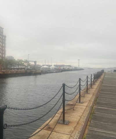
Photographs from Pier 3 in the remnants of tropical storm Fred. (C Nicodemus)
1. A view across the granite walls of Dry Dock 2 and across piers 4 and 5 to East Boston
2. A view South West over the Cassin Young to the North End of Boston.